
By Pablo Bello, official mountain tourism guide at Andean Raju Expeditions · Updated October 2026
There are higher mountains in the Cordillera Blanca, and there are harder ones. But there is only one Alpamayo. Its southwest face, a near-perfect pyramid of fluted ice rising above a glacier, has been hanging on climbers’ walls since the 1960s, and it still stops conversations in Huaraz cafés when someone mentions they’ve just come down from it.
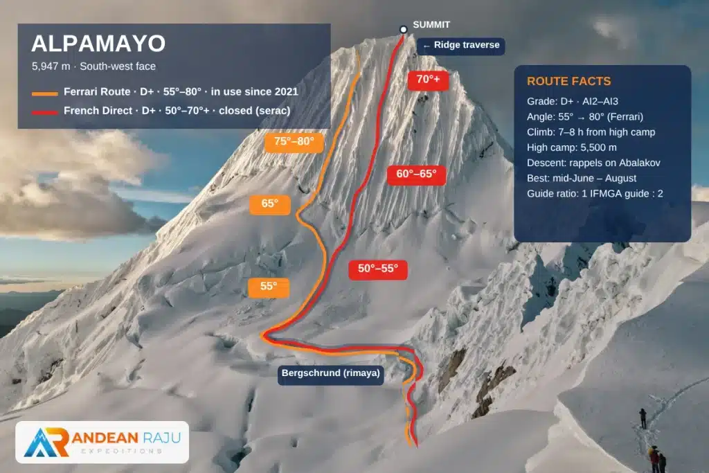
In short: Alpamayo is a 5,947 m (19,511 ft) peak in Peru’s Cordillera Blanca, about three hours by road and two days on foot from Huaraz. Since 2021 the route in use is the Ferrari route on the southwest face: a bergschrund, then a long runnel that starts at 55° and steepens to 80° near the top, followed by a short traverse along the ridge to the summit. Expect around 7 hours of climbing, then a descent by rappel. A guided expedition takes 7 days from Huaraz, and the best window is the second half of June through the end of August. It’s physically demanding and technically difficult (D+): you need real ice-climbing experience before you come.
We guide Alpamayo every season, and we’ve seen how quickly the mountain changes. In 2021 one of our guides led the first expedition of the season and found a huge serac hanging above the French Direct, the classic line until 2019. He switched the team to the Ferrari route, and that’s the line expeditions have used since. Only three expeditions reached the summit that year; one of them was ours, a father-and-son rope team from Mexico. A year later, when huge cornices threatened the face again, ExplorersWeb asked us about conditions on the route (read the report). What follows is what we’d tell you over coffee before you commit: the real route, how hard it is, how to acclimatize, and how to arrive ready.
Alpamayo at a Glance
| Summit | 5,947 m (19,511 ft) |
| Location | Cordillera Blanca, Huascarán National Park, Ancash, Peru |
| Route in use | Ferrari route, southwest face (in use since 2021; confirmed each season) |
| Difficulty | Technically difficult (D+), physically demanding |
| The climb | 55° to 80° snow and ice in a long runnel, then a ridge traverse; about 7 hours up |
| Descent | Rappels down the same line |
| Base town | Huaraz, 3,100 m (10,170 ft) |
| Approach | In via Vaquería and the Punta Unión pass (4,750 m), out via Cashapampa |
| Camps | Base camp ~4,300 m · Moraine camp ~4,800 m · High camp ~5,500 m (18,000 ft) |
| Expedition length | 7 days / 6 nights from Huaraz, plus acclimatization days before |
| Season | May to August; best from mid-June to the end of August |
| Guiding | Certified IFMGA (UIAGM) mountain guide, maximum 2 climbers per guide with Andean Raju |
The Mountain: Why Alpamayo Is Different
Alpamayo sits at the northern end of the Cordillera Blanca, inside Huascarán National Park, between the Santa Cruz valley and the Alpamayo valley. From Huaraz you don’t see it at all. It hides behind a wall of other giants, and that is part of its magic: you earn the first view after two days of walking, when the face suddenly appears above the moraine.
“The Most Beautiful Mountain in the World”
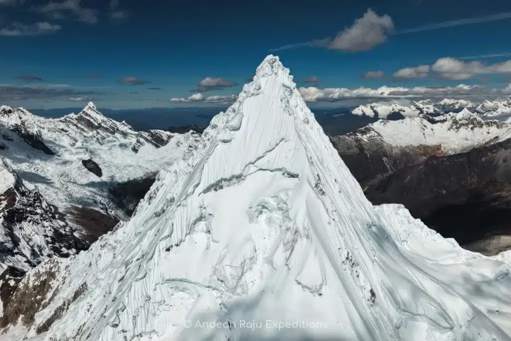
In 1966 the German magazine Alpinismus published a photograph of Alpamayo’s southwest face and called it the most beautiful mountain in the world. The title stuck. What makes the face so striking is its symmetry: a steep pyramid of snow and ice, scored top to bottom by parallel flutings, with a corniced summit ridge on top. In the afternoon light it turns gold, then pink, then blue.
How do you say it? Alpamayo is pronounced “al-pa-MY-oh.” The name is usually explained as Quechua for “earth river” (allpa, earth; mayu, river).
A Short History of the Climb
- 1951: A Franco-Belgian expedition, including the French alpinist Claude Kogan, reported the first ascent by the north ridge. Later study of their photographs showed they had stopped below the true summit.
- 1957: Germans Günter Hauser, Bernhard Huhn and Horst Wiedmann reached the real summit on June 20, also by the north ridge.
- 1975: An Italian team led by Casimiro Ferrari climbed the southwest face. The Ferrari route became the classic line for almost three decades.
- 2003: On July 21, a cornice collapse above the southwest face triggered an ice avalanche that killed eight climbers on the Ferrari route. In the years that followed, most parties moved to the French Direct, a slightly steeper line in the center of the face.
- 2021: After the pandemic pause of 2020, a huge serac formed above the French Direct. Our guide leading the first expedition of the season switched to the Ferrari route, which has been the line in use since. Only three expeditions summited that season, one of them ours.
The Routes on the Southwest Face
| Route | Character | Status today |
|---|---|---|
| Ferrari | Bergschrund, a long runnel from 55° steepening to 80°, and a ridge traverse to the summit | The route in use since 2021 |
| French Direct | Central runnel, 50–65° steepening to 70°+, about 8 pitches | The classic line until 2019; closed since 2021 by a dangerous serac above it |
| Vasque-French | A line close to seracs | Rarely the safest choice |
| North ridge | The historic first-ascent route, long and corniced | Very rarely climbed |
Which line we use is decided on the mountain, each season and sometimes each week, by what the cornices and seracs above the face are doing. Since 2021 the French Direct has sat under a dangerous serac, and it may take several years before it’s safe to climb again. Our honest advice: book a guide who will tell you no when the face is not safe, and have a plan B ready.

Plan B: Quitaraju
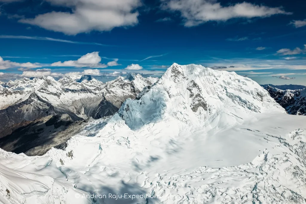
Alpamayo shares its high camp with Quitaraju (6,036 m / 19,800 ft), its taller and less famous neighbor. When Alpamayo’s face is out of condition, Quitaraju’s north face is often the best alternative from the same camp: steep snow and ice of 50–70°, slightly less sustained, with a summit above 6,000 m. Many climbers end up doing both.
Is Alpamayo Right for You?

Alpamayo is not a first mountain. It’s the climb people build toward over a few seasons. Answer these questions honestly before you book:
- Have you climbed above 5,000 m (16,400 ft) before? Peaks like Yanapaccha, Vallunaraju or Mateo in the Cordillera Blanca, or Chimborazo, Cotopaxi or Huayna Potosí elsewhere in the Andes, are the usual stepping stones.
- Can you climb steep ice with two tools? You should be confident front-pointing on 55–65° snow and ice for several pitches in a row, and comfortable on steeper sections of up to 80°. Grade WI3 waterfall ice or AI2–3 alpine ice at home is a good benchmark.
- Do you know your rope work, on ice and on rock? Clipping into anchors, belaying your partner, and rappelling with a backup on your own, in gloves and in the dark, without having to think about it.
- Can you handle a long summit day? You wake at midnight and climb for 7–8 hours above 5,500 m (18,000 ft), in temperatures of –10 to –15 °C (14 to 5 °F).
- Will you accept turning back? On Alpamayo the mountain decides. A good season sees most guided teams summit; a bad one sees almost nobody do it.
Five confident yeses, and you’re ready. If two or more feel shaky, spend one season building up: a guided climb of Yanapaccha (with our two-day ice course) or Mateo, an ice course in the Alps or at home, and Alpamayo the following year. Want a route into the Cordillera Blanca? Read our Nevado Mateo guide for a first 5,000 m climb.
What We Ask Before We Confirm Your Place
Because we climb at a maximum of two clients per IFMGA guide, the whole rope team depends on each person. Before confirming, we ask for a short climbing CV: your highest summits, technical ice routes you’ve led or followed, and recent training. If we think you need a warm-up peak or a skills day first, we’ll tell you, and build it into your plan.
The Alpamayo Expedition, Day by Day
Our classic Alpamayo expedition takes 7 days and 6 nights from Huaraz. It’s the itinerary that gives you the best chance of reaching the summit in good shape, because it includes a night at the moraine camp instead of pushing straight from base camp to high camp. Before it, plan on several days of acclimatization around Huaraz, ideally with one or two warm-up climbs. If you’d like a spare day for weather, we can add one.
Before the Expedition: Acclimatization in Huaraz
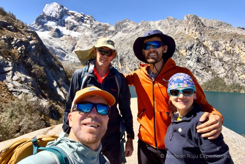
Spend at least two nights in Huaraz before any hike, then build up gradually. These are the hikes and climbs we recommend; we’ll tailor the mix to your experience and your time:
| Option | Highest point | Time | Why it helps |
|---|---|---|---|
| Laguna Wilcacocha | 3,745 m (12,286 ft) | 2.5 h, 10.8 km round trip | Easy first day with a view of the whole Cordillera Blanca |
| Laguna Radián | 3,900 m (12,795 ft) | 2 h, 8.4 km round trip | Quiet, gentle walk with views of Huascarán and Copa |
| Laguna Churup | 4,450 m (14,599 ft) | 2.5 h from Pitec | Steep and short: builds altitude and leg strength |
| Laguna 69 | 4,604 m (15,104 ft) | 3 h up, 12 km | The best test of your fitness and acclimatization |
| Nevado Huarapasca | 5,413 m (17,759 ft) | 1 day | Short steep walls for climbers with glacier experience |
| Nevado Yanapaccha | 5,460 m (17,913 ft) | 3 days, including a 2-day ice course | Ice climbing, knots, rappels and safety before the summit |
| Nevado Vallunaraju | 5,686 m (18,655 ft) | 2 days from Huaraz | A full night above 5,000 m and a glacier climb |
Of these, Yanapaccha and Huarapasca make the biggest difference: they sharpen the two things Alpamayo tests hardest, endurance and technical climbing at altitude.
The Expedition
| Day | Route | Sleep at | Time |
|---|---|---|---|
| 1 | Huaraz → Vaquería (3,700 m) by road via the Llanganuco lakes, trek to Tucto | ~4,250 m (13,940 ft) | 3 h drive + 4–5 h |
| 2 | Tucto → Punta Unión pass (4,750 m / 15,580 ft) → Alpamayo base camp | ~4,300 m (14,100 ft) | 4–5 h |
| 3 | Base camp → Moraine camp | ~4,800 m (15,750 ft) | 3–4 h |
| 4 | Moraine camp → High camp | ~5,500 m (18,000 ft) | 4–5 h |
| 5 | Summit day: Ferrari route, rappel back to high camp | ~5,500 m (18,000 ft) | 7–8 h up + descent |
| 6 | High camp → Base camp | ~4,300 m (14,100 ft) | 4–5 h |
| 7 | Base camp → Cashapampa (2,900 m), drive to Huaraz | 3,100 m (10,170 ft) | 5–6 h + 3 h drive |
Day 1 — Into the mountains through Llanganuco. We drive north to Yungay and up the Llanganuco gorge, past the turquoise lakes of Chinancocha and Orconcocha below Huascarán and Huandoy, then over the Portachuelo de Llanganuco to the village of Vaquería (3,700 m), where our arrieros are waiting with their donkeys. From there a 4–5 hour walk (13.5 km) through Quechua farmland and quinoa fields takes us up the Huaripampa valley to camp at Tucto (4,250 m), already sleeping higher than Huaraz.
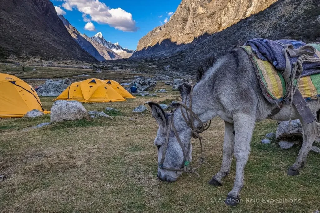
Day 2 — Over Punta Unión. We climb steadily to the Punta Unión pass (4,750 m / 15,580 ft), the highest point of the Santa Cruz trail, where Taulliraju’s ice wall suddenly fills the sky and the whole Santa Cruz valley opens below you. From the pass we descend past Taullicocha and across the meadows of Taullipampa, with Artesonraju, Quitaraju and finally Alpamayo coming into view, to base camp by a small stream, the last running water of the trip. Crossing a 4,750 m pass on day two is also excellent acclimatization for the climb ahead.
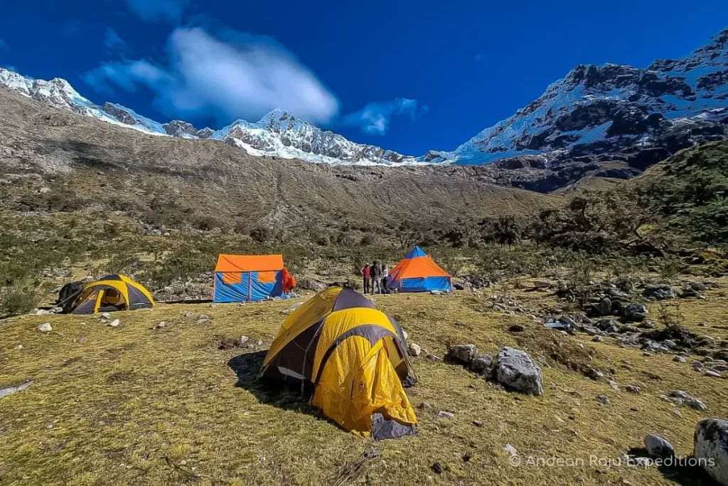
Day 3 — Up the moraine. The climb really begins here: a dry, rocky and sandy path up the moraine, with Laguna Arhuaycocha shining below the glaciers of the Pucajirkas. Drink well the day before, because there is no water at moraine camp. On our expeditions the cook and porters bring ice from the glacier and melt it for the group.
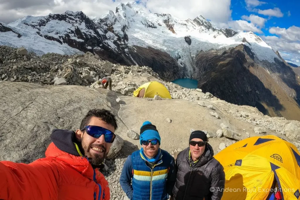
Day 4 — To high camp. A short walk to the glacier, then we rope up and climb through crevasses to the technical sections below the col. In recent seasons new crevasses have opened, and this stretch now involves real ice climbing too, which is why we break the ascent with a night at the moraine. High camp is the reward: one of the most spectacular sunsets in the Peruvian Andes. Early dinner, and into the sleeping bag.
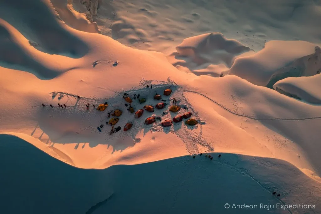
Day 5 — Summit day. Wake-up at midnight, breakfast, harness on, and a short approach to the face. The Ferrari route starts with a bergschrund of soft snow; above it, the runnel usually offers better snow and the climbing gets beautiful, starting at 55° and steepening to 80°. At the top of the face, a traverse along the ridge leads to the summit. As you gain height, Quitaraju, Santa Cruz and the rest of the Cordillera Blanca appear one by one, and dawn on the face is unforgettable. The ascent takes around 7–8 hours. We rappel the same line, taking special care on the steepest sections, and are usually back at high camp between 10 and 11 am. Strong teams can choose to continue down to base camp the same afternoon, where you sleep and recover better.
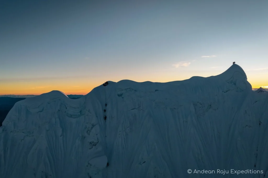
Day 6 — Back to base camp. Rappels off the col, across the glacier and down the moraine, and suddenly the air feels thick again.
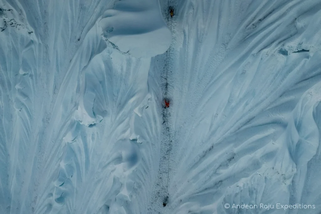
Day 7 — Back to Huaraz. A long, easy descent down the Santa Cruz valley, past the big lake of Jatuncocha and through the Santa Cruz canyon, to the village of Cashapampa (2,900 m), where transport is waiting to take you back to Huaraz for a hot shower and a celebration dinner in town.
Why We Go In Through Vaquería and Punta Unión
Most operators run Alpamayo as an out-and-back from Cashapampa: up the dry Santa Cruz canyon to base camp, and down the same way. It’s shorter, but you walk the same trail twice, and the first day is a hot, dusty climb through the gorge.
We enter from the other side. Starting at Vaquería turns the approach into a traverse of the whole Santa Cruz trek: the Llanganuco lakes beneath Huascarán, Peru’s highest mountain, on the drive in; a first night at 4,250 m; and the crossing of Punta Unión, one of the most famous viewpoints in the Cordillera Blanca, before you even reach base camp. It’s a more spectacular way to arrive, it gains altitude more gradually, and the pass gives your body one more push above 4,700 m before the climb. We come out through Cashapampa, so you see both sides of the valley and never repeat a step.
Alternative Approach: The Alpamayo Valley
The historic approach goes from the north side, starting at Hualcayán and passing Laguna Cullicocha to a base camp near Laguna Jancarurish (about 4,500 m). It takes 2½ to 3 days to reach base camp, crosses a 4,800 m pass and sees far fewer people. We can arrange it as a longer private expedition that combines trekking and climbing.
How Hard Is Alpamayo?
Alpamayo is graded D+ on the French alpine scale, the upper end of “difficile”: physically demanding and technically difficult. In plain words: it’s a serious technical climb, but not an extreme one. What makes it hard is not one crux move but the sum of things: a long, sustained wall of steep snow and ice, at almost 6,000 m, in the cold and dark, followed by a long series of rappels when you’re already tired.
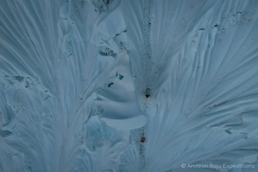
The Ferrari Route, Step by Step
- The approach to high camp. Before you even reach the face, the glacier between the moraine and high camp now has new crevasses and short sections of ice climbing. On Alpamayo, the hard work starts a day early.
- The bergschrund. The crevasse at the foot of the face changes every year. On the Ferrari it’s usually a lip of soft, loose snow that takes care and patience to cross.
- The runnel. Above it, the route follows a long channel up the face. The snow is usually firmer here, and the climbing becomes a pleasure: it starts at around 55° and steepens steadily.
- The final section. Near the top the angle reaches 80° for the last stretch of the wall, often through mushrooms of rime ice.
- The ridge. Once out of the face, a traverse along the corniced summit ridge leads to the top. Your guide decides how far along the ridge is safe on the day.
- The descent. You rappel the same line, using V-thread anchors (Abalakov threads) drilled into the ice and snow anchors as backup. By mid-season the route is open and you’ll find established rappel points.
- Objective hazard. The runnels on Alpamayo’s face regularly channel falling ice and small slides from high above. Early starts, moving efficiently and a guide who reads the face are your best protection.
Altitude: The Part You Can’t Rush
High camp is at about 5,500 m (18,000 ft), where there’s about half the oxygen available at sea level. Most failed attempts on Alpamayo don’t fail on the face; they fail because someone arrived at high camp without enough acclimatization and couldn’t sleep, eat or recover. That’s why our program includes acclimatization days and a warm-up peak before the expedition, and why we gain height gradually through four camps, including a night at the moraine.
Altitude Sickness: Warning Signs and What We Do
- Mild AMS: headache, nausea, poor sleep, loss of appetite. Common at base camp and usually improves with rest, water and a slower pace.
- Danger signs: a headache that doesn’t respond to painkillers, vomiting, confusion, loss of balance (HACE), or breathlessness at rest and a wet cough (HAPE). These mean descending immediately.
- What we carry: a full first-aid kit, emergency oxygen, a pulse oximeter, and emergency communication equipment.
Objective Hazards
Alpamayo’s beauty comes with risk. The main hazards are falling ice and cornice collapse from the summit ridge, crevasses on the glacier approach, and storms that blow in from the Amazon side. We manage them with early starts, by checking conditions with other guides in Huaraz before every departure, and by turning around when the face isn’t safe.
Evacuation and Rescue
If someone gets sick or injured, we descend first: from high camp to base camp in a few hours, and from there by donkey or on foot to Cashapampa, where our vehicle can reach Caraz or Huaraz. For serious accidents in the Cordillera Blanca, the police high-mountain rescue unit (USAM), based in Yungay, and the Casa de Guías rescue team can respond. Helicopter evacuation is possible but depends on weather and availability, which is why travel insurance with mountain rescue cover is essential.
Training: A 12-Week Plan
Start at least three months before your trip:
- Weeks 1–4: Build your base. Three to four cardio sessions a week (hiking, running, cycling), building up to 90 minutes, plus two strength sessions focused on legs and core.
- Weeks 5–8: Add height and weight. Long hikes on weekends with 1,000–1,500 m (3,300–5,000 ft) of ascent carrying 10–12 kg (22–26 lb). Add calf raises and step-ups, which save your calves on long front-pointing sections.
- Weeks 9–11: Get specific. Climb ice if you can: an ice course, a waterfall, an alpine route. Practice rappelling and anchor work until it’s automatic. If you live far from ice, a climbing gym with a rope-work session still helps.
- Week 12: Taper. Shorter, easier sessions so you arrive in Huaraz rested.
When Is the Best Time to Climb Alpamayo?
The climbing season runs from May to August, during the Andean dry season, when the weather is usually stable, the summits are clear and avalanche risk is lower. From our experience on this mountain every year, the best window is narrower: from the second half of June to the end of August, when both the face and the weather tend to be at their best. Mountain weather changes fast, and with climate change it’s less predictable than it used to be, so we check conditions constantly before and during every expedition.
| Month | Weather | Face conditions | Our view |
|---|---|---|---|
| May | Last storms of the wet season, then clearing | Fresh, often deep snow; cornices can be big | Early; possible but less reliable |
| June (first half) | Usually stable, cold | Route often still being opened | Good with flexibility |
| Mid-June to July | Stable, cold, clear | Usually the best snow and ice | Best window |
| August | Stable, windier | Firmer ice, route well traced | Best window |
| September | More cloud and afternoon snow | Variable | Only with current reports |
| October–April | Wet season | Not recommended | — |
Temperatures by Altitude
| Place | Altitude | Day | Night |
|---|---|---|---|
| Huaraz | 3,100 m (10,170 ft) | 18–22 °C (64–72 °F) | 3–7 °C (37–45 °F) |
| Base camp | 4,300 m (14,100 ft) | 10–15 °C (50–59 °F) | –3 to –6 °C (27 to 21 °F) |
| High camp | 5,500 m (18,000 ft) | 0–5 °C (32–41 °F) in sun | –10 to –15 °C (14 to 5 °F) |
| Summit ridge | 5,947 m (19,511 ft) | — | –15 °C (5 °F) or colder with wind |
A note on conditions: Alpamayo’s face changes from year to year, and sometimes from week to week. We share current reports with every client in the weeks before departure, and we’re in touch with the other guides on the mountain throughout the season.
How to Get to Alpamayo
Lima to Huaraz. Fly into Jorge Chávez International Airport in Lima, then travel north to Huaraz (3,100 m / 10,170 ft), about 8 hours by road. Buses cost roughly S/ 60–90 (US$ 20–30) depending on the service. We recommend Cruz del Sur for punctuality, comfort and safety; Móvil Bus’s Premier service is also comfortable. Both sell tickets online and accept international cards. If you’d rather fly, LATAM operates flights between Lima and Anta airport, 40 minutes to an hour by road from Huaraz, which saves most of a day.
Huaraz to the trailhead. Our expedition starts in Vaquería: north through the Callejón de Huaylas to Yungay, then up through the Llanganuco gorge and over the Portachuelo pass, about 3 hours in total. It ends in Cashapampa, 3 hours from Huaraz via Caraz. On our expeditions, private transport picks you up at your hotel and brings you back from Cashapampa at the end. (Most other operators start and finish in Cashapampa; see “Why We Go In Through Vaquería and Punta Unión” above.)
Your extra luggage. Leave your city clothes and travel bags with us or at your hotel in Huaraz while you climb.
How many days in total? Allow around 15–16 days from Lima: a travel day to Huaraz, 5–6 days of acclimatization with a warm-up climb, the 7-day expedition, and a buffer day before your flight home.
Permits, Costs and Choosing a Guide
Huascarán National Park Fees
Alpamayo lies inside Huascarán National Park, a UNESCO World Heritage Site. Every climber pays the park entrance fee at the control point or buys it in advance. These are the current rates for foreign visitors (2026, source):
| Ticket | Foreign visitors |
|---|---|
| 1 day | S/ 30 |
| 2–3 days | S/ 60 |
| 4–30 days | S/ 150 (about US$ 40) |
An Alpamayo expedition needs the 4–30 day ticket, and the same ticket also covers your acclimatization hikes and warm-up climb inside the park if you’re within the 30 days. Keep it with your passport; rangers check both. Your quote will tell you whether the park ticket is included.
What Shapes the Cost of an Alpamayo Climb
Alpamayo prices vary widely in Huaraz, and the difference is almost always in what’s behind the price:
- The guide. An IFMGA (UIAGM) mountain guide costs more than an aspirant or an informal guide, and for a technical face it’s worth it.
- The guide-to-client ratio. 1:2 is the safe standard on Alpamayo. Some cheaper offers put three or four clients on one rope.
- Days. A 7-day expedition with a night at the moraine camp costs more than a 5-day rush, and gives you a much better chance of the summit.
- Porters and logistics. Donkeys to base camp, porters to the high camps, a cook at base camp, tents rated for high altitude.
- Safety equipment. Oxygen, pulse oximeter, communication, a real first-aid kit.
We don’t publish a single price because every Alpamayo expedition we run is built around your experience, your dates and how many days you need for acclimatization. Ask us for a quote and we’ll send you a detailed program within 24 hours.
Guided or Independent?
Experienced alpinists do climb Alpamayo independently. If that’s you, you’ll need your own rack (pickets, screws, V-thread tools), your own logistics to base camp, and the latest beta from Huaraz, as the face changes every season. For everyone else, a guide removes the hardest part: making the right call on conditions, leading the steep pitches, and building the rappel anchors when you’re exhausted.
Why We Climb at 1:2 With IFMGA Guides
On Alpamayo, every one of our rope teams is led by a guide certified by the IFMGA (International Federation of Mountain Guides Associations), the highest qualification in mountaineering, with a maximum of two clients per guide. In practice, that means:
- Your guide leads every pitch and belays you from a solid anchor.
- There’s always someone with the experience to turn the team around, and the authority to do it.
- With only two clients, the team moves faster, which matters on a face where the sun reaches the cornices by late morning.
- If one climber has to turn back, the team can adapt without ending the climb for everyone; we agree the plan with you before departure.
How to Choose an Alpamayo Operator
Before you book, ask:
- Who will my guide be, and what’s their certification? Ask for the name, and check that they’re IFMGA certified for a technical face like this.
- How many clients per guide on summit day? Anything above 1:2 on Alpamayo’s face is a red flag.
- Does the itinerary include a night at the moraine camp, and can a reserve day be added? Without them, one bad day can end your expedition.
- What happens if the face isn’t safe? A good operator has a plan B (Quitaraju, or another day) instead of pushing on.
- What safety and communication equipment comes on the climb?
- Is it a legally registered agency? A licensed local agency is legally responsible for your trip, can organize rescue and insurance paperwork, and has to work with certified guides. Ask for its registration details before you pay, and never buy a climb from touts at the bus terminals: street sales of tourist services are illegal in Peru and often end badly.
Alpamayo Gear List
Everything you can’t fit in your duffel can be rented in Huaraz, but technical items you rely on (boots, harness) are best brought from home and broken in. Ask us what we can provide when you book.
Technical Gear
- Double or high-altitude mountaineering boots rated to at least –20 °C (–4 °F)
- 12-point crampons with anti-balling plates, fitted to your boots before you arrive
- Two technical ice tools (one can be a technical axe with a curved shaft)
- Climbing harness that fits over your down layers
- Helmet
- Belay/rappel device, 3–4 locking carabiners, 2 slings and a Prusik or auto-block cord
- Ascender (optional, useful on the col)
The rope, pickets, ice screws and group anchors are carried by your guide.
Clothing
- Base layers: merino or synthetic top and bottom, two sets
- Mid layers: fleece and a light insulated jacket
- Hard shell jacket and pants (Gore-Tex or similar)
- Expedition down jacket with hood for high camp and the summit
- Insulated pants or a softshell with long underwear
- Gloves: liner gloves, climbing gloves, and warm mittens
- Warm hat, buff, sun hat and glacier glasses (category 4) plus ski goggles
Camping and Personal Items
- Down sleeping bag rated to –25 to –30 °C (–13 to –22 °F), as you’ll sleep at about 5,500 m; you can bring your own or rent one from us
- Insulated sleeping pad
- 60–70 L pack for the climb, a 20–30 L day pack for the approach, and a duffel for the donkeys
- Headlamp with spare batteries (lithium handle the cold best)
- Two 1-liter water bottles with insulated covers, plus a thermos
- Sunscreen SPF 50+, lip balm with SPF
- Personal first-aid kit and any prescribed medication
- Energy snacks you like: at altitude, food you enjoy is food you’ll actually eat
Life on the Mountain
Our team on an Alpamayo expedition: your IFMGA guide (one for every two climbers), a cook, arrieros with donkeys to base camp and porters for the high camps when needed. At base camp you’ll eat hot meals in a dining tent, cooked fresh; we cater for vegetarian, vegan and gluten-free diets if you tell us before the trip. Every day you also get a snack bag for the trail. Above base camp, meals are simpler, quick and warm: soups, pasta, hot drinks and plenty of water melted from snow by our team.
There’s no phone signal for most of the route, from Vaquería until you’re back in Cashapampa. Charge everything in Huaraz and bring a power bank; a small solar panel helps on longer trips.
Tipping Your Team
Tips aren’t mandatory but are part of mountain culture in Peru, and for porters and arrieros they’re an important part of their income. As a rough guide, many climbers give around 10% of the trip cost, split between the guide, cook, porters and arrieros. Give it in soles, in person, on the last day.
Mistakes We See Every Season
- Arriving straight from sea level and wanting to climb in four days. The acclimatization days aren’t padding; they’re what gets you up the face.
- New boots. Blisters on day one of the approach can end a climb before you’ve seen the glacier.
- Learning rope work on the mountain. Practice rappelling and anchor changes at home, in gloves.
- Too little warm clothing for summit day. The coldest hours are before sunrise, standing at belays.
- Choosing the cheapest offer. On Alpamayo, the difference in price is usually a guide with less experience, more clients per rope, or no reserve day.
- Pushing from base camp to high camp in one go. With the new crevasses below the col, many teams have had to change plans after trying it. A night at the moraine saves energy for summit day.
- Not accepting the mountain’s no. Some seasons the face isn’t safe. The summit will still be there next year.
Alpamayo FAQ
How high is Alpamayo?
Alpamayo is 5,947 m (19,511 ft) high. It’s in the northern Cordillera Blanca, inside Huascarán National Park in Peru.
Why is Alpamayo called the most beautiful mountain in the world?
In 1966 the German magazine Alpinismus published a photo of its southwest face and gave it that title. The near-perfect pyramid of fluted ice has been one of the most photographed mountains in the Andes ever since.
How difficult is Alpamayo?
Alpamayo is graded D+: physically demanding and technically difficult. The Ferrari route climbs a long runnel of snow and ice from 55° to 80°, then traverses the ridge to the summit, at almost 6,000 m. It’s a serious technical climb that requires previous ice-climbing and high-altitude experience.
Can a beginner climb Alpamayo?
No. You should have climbed at least one peak above 5,000 m and be comfortable on steep ice with two tools before attempting Alpamayo. Yanapaccha, Vallunaraju or Mateo are good first climbs in the Cordillera Blanca.
How many days do you need to climb Alpamayo?
Our expedition takes 7 days from Huaraz, entering via Vaquería and the Punta Unión pass and coming out via Cashapampa. Add 5–6 days of acclimatization with a warm-up climb beforehand, so plan on about 15–16 days from Lima.
Which is the normal route on Alpamayo?
Since 2021 it’s the Ferrari route on the southwest face. The French Direct, the classic line until 2019, has been closed by a dangerous serac above it. The line chosen each season always depends on the cornices and seracs.
When is the best time to climb Alpamayo?
From May to August, in the dry season. In our experience, the best conditions are from the second half of June to the end of August.
How cold is it on Alpamayo?
At high camp (about 5,500 m) nights drop to –10 to –15 °C (14 to 5 °F), and it can be colder on the summit ridge with wind. Summit day starts around midnight, so expect the coldest hours on the face.
Do I need a guide to climb Alpamayo?
It’s not required for very experienced alpinists, but most climbers go with a certified guide. We climb with IFMGA (UIAGM) guides at a maximum ratio of two clients per guide.
How much does it cost to climb Alpamayo?
It depends on the number of days, the guide’s certification and the client-to-guide ratio. The park entrance fee for foreign visitors is S/ 150 for 4–30 days. Contact us for a quote built around your experience and dates.
What’s the success rate on Alpamayo?
It depends heavily on the season. In good years most well-acclimatized guided teams reach the top; in years with dangerous cornices, few do. A reserve day and a flexible plan make the biggest difference.
Is Alpamayo good preparation for peaks like Ama Dablam?
Yes. Alpamayo builds the endurance and the technical skill on steep snow and ice that bigger technical objectives such as Ama Dablam demand.
What is Quitaraju, and can I climb both?
Quitaraju (6,036 m) is Alpamayo’s neighbor, climbed from the same high camp. It’s often the plan B when Alpamayo’s face isn’t safe, and strong teams sometimes climb both on the same expedition.
Do I need travel insurance?
Yes. Make sure it covers mountaineering above 6,000 m and helicopter rescue. Many standard travel policies don’t.
Can I rent climbing gear in Huaraz?
Yes. Boots, crampons, ice tools, harnesses, down jackets and sleeping bags can all be rented in Huaraz. Bring boots from home if you can, already broken in.
Is there phone signal on Alpamayo?
Not for most of the route. Expect to be offline from Vaquería until you reach Cashapampa at the end; your guide carries emergency communication.
What’s the difference between Alpamayo and Huascarán?
Huascarán (6,768 m) is Peru’s highest mountain: a long, high-altitude glacier climb with crevasses and seracs. Alpamayo is lower but steeper and more technical: a short, sustained ice face. Many climbers do Alpamayo first, then Huascarán.
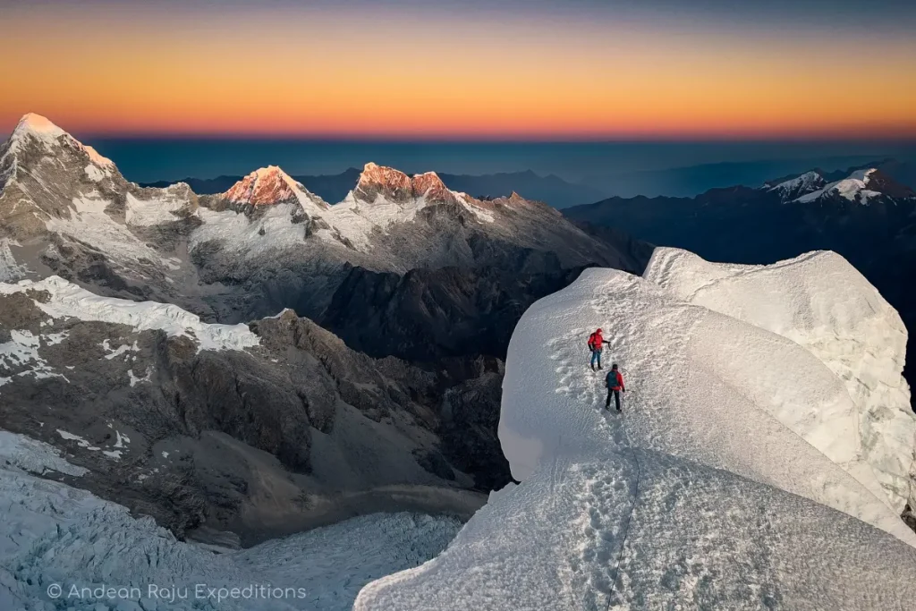
Climb Alpamayo With Guides Who Know Its Moods
Andean Raju Expeditions is a legally registered agency based in Huaraz. We climb Alpamayo every season with IFMGA (UIAGM) mountain guides at a maximum of two clients per guide, our own cooks, arrieros and camp equipment, and an itinerary built around proper acclimatization and a night at the moraine camp.
Send us your climbing experience and preferred dates, and one of our guides will reply personally within 24 hours with a program built for you.
WhatsApp: +51 965 440 899 · Email: info@andeanrajuexpeditions.com
Get your Alpamayo expedition quote →
Not ready for Alpamayo yet? Start with a warm-up climb on Yanapaccha or Mateo, or walk the Huayhuash circuit.
[…] Read this guide in English […]