
By Pablo Bello, official mountain tourism guide at Andean Raju Expeditions · Updated September 2026
Ask a room of Andean guides to name the finest trek in Peru, and very few will say the Inca Trail. Most will say Huayhuash. The circuit wraps around a small, fiercely glaciated range a few hours from Huaraz, and for the better part of ten days it serves up the kind of view most treks save for the final morning.
In short: the Huayhuash trek is a 110–130 km (70–80 mile) loop (about 109 km on our 10-day route) around Peru’s Cordillera Huayhuash, usually walked in 8 to 10 days between May and September. It crosses eight high passes, the highest at 5,100 m (16,730 ft), plus a viewpoint hike to 5,120 m (16,797 ft), and camps beside glacial lakes in the second-highest tropical mountain range in the world, beneath Yerupajá, the second-highest mountain in Peru. It’s demanding but not technical: no ropes or climbing skills needed, just solid fitness and proper acclimatization.
We lead groups around this range every season, and we’ve lost count of the number of first-timers who fall silent when Carhuacocha comes into view. What follows is what we’d tell you over coffee in Huaraz before you commit: the real route, how hard it is, what it costs, and how to arrive ready.
In this guide:
- The Huayhuash Trek at a Glance
- Where Is the Huayhuash Trek?
- Is the Huayhuash Right for You?
- The Cordillera Huayhuash: A Small Range With Giant Peaks
- The Huayhuash Circuit, Day by Day
- How Hard Is the Huayhuash Trek?
- When Is the Best Time to Trek the Huayhuash?
- How to Get to the Huayhuash
- How Much Does the Huayhuash Trek Cost?
- Solo, With Friends or in a Group?
- Life on the Trail: What a Day Really Looks Like
- Huayhuash Packing List
- Safety and Responsible Trekking
- Mistakes We See Every Season
- Huayhuash Trek FAQ
The Huayhuash Trek at a Glance
| Distance | About 109 km (68 mi) on our 10-day route; 110–130 km (70–80 mi) on other classic loops; up to 180 km (110 mi) with every side trip |
| Duration | 6 to 12 days; most people choose 8 or 10 |
| Passes | 8 on our route, most between 4,600 and 5,100 m (15,100–16,730 ft) |
| Highest point | 5,120 m (16,797 ft) at the Gran Vista viewpoint; highest pass 5,100 m (16,730 ft) at Santa Rosa |
| Lowest night | Huayllapa village, around 3,500 m (11,500 ft) |
| Total ascent | Roughly 7,000–8,000 m (23,000–26,000 ft) |
| Season | May to September |
| Trailhead | Cuartelhuain, about 5 hours by road from Huaraz |
| Community fees | About S/ 290–300 per person (2026), roughly US$ 80–85 |
| Guided departures | 10-day circuit from US$ 870 per person with Andean Raju |
Where Is the Huayhuash Trek?
The Cordillera Huayhuash sits in the central Peruvian Andes, just south of the better-known Cordillera Blanca and a long day’s drive north of Lima. The range straddles three regions (Ancash, Huánuco and Lima), and the trek loops all the way around it, crossing between valleys that drain to both the Pacific and the Amazon.
Your base is Huaraz, the trekking capital of Peru, at 3,050 m (10,000 ft). That’s where you’ll acclimatize, rent gear and meet your team before driving to the trailhead at Cuartelhuain via the town of Chiquián.
How do you say it? Huayhuash is pronounced “WHY-wash.” The name is Quechua, and locals say it’s the word for a small weasel that lives in these mountains.
Is the Huayhuash Right for You?
Answer these four questions honestly before you book:
- Have you done a multi-day hike before? Not necessarily at altitude, but you should know how your legs feel on the third long day in a row.
- Can you spend three or four days in Huaraz first? Skipping acclimatization is the most common reason people turn back.
- Can you handle the cold? Nights regularly fall below –5 °C (23 °F), and can reach –10 °C (14 °F) in June and July.
- Do you want wilderness more than comfort? There are no lodges, no shops and, for most of the loop, no phone signal.
Four yeses, and you’ll probably love it. If two or more feel shaky, the four-day Santa Cruz trek is a smarter first step, with the Huayhuash as next year’s goal.
The Cordillera Huayhuash: A Small Range With Giant Peaks
By Andean standards the Huayhuash is tiny, only about 30 km (19 miles) from end to end. What it lacks in length it makes up for in height: it is the second-highest tropical mountain range in the world, after its neighbor, the Cordillera Blanca. Six summits top 6,000 m (19,700 ft), packed so tightly that from some campsites you can take in half of them without turning your head.

| Peak | Altitude | Best seen from |
|---|---|---|
| Yerupajá | 6,617 m (21,709 ft) | Carhuacocha at sunrise; Jahuacocha from the west |
| Siula Grande | 6,344 m (20,814 ft) | Cutatambo and the passes above it |
| Sarapo | 6,127 m (20,102 ft) | The Siula pass and the Tres Lagunas viewpoint |
| Jirishanca | 6,094 m (19,993 ft) | Carhuacocha, beside Yerupajá |
| Yerupajá Chico | 6,089 m (19,977 ft) | Carhuacocha |
| Rasac | 6,017 m (19,741 ft) | The western side, above Jahuacocha |
| Rondoy | 5,870 m (19,259 ft) | Jahuacocha |
Yerupajá is Peru’s second-highest mountain after Huascarán, and its ice-plastered south face is one of the most serious walls in the Andes. Jirishanca, whose Quechua name is usually translated as “icy hummingbird’s beak,” looks exactly like its name from the shore of Carhuacocha.
A Range Cared for by Its Communities
There’s no national park ticket office here. The land belongs to rural communities, and in 2002 the Peruvian government declared the range a reserved zone, a move that helped keep large-scale mining out. Today the communities run their own campsites, collect a modest fee and supply many of the arrieros (muleteers) who move gear around the circuit. The small fee you pay at each campsite is a direct investment in keeping these valleys the way they are.
The Mountain From Touching the Void
In 1985 two British climbers, Joe Simpson and Simon Yates, made the first ascent of Siula Grande’s west face. On the way down Simpson shattered his leg, fell into a crevasse and was presumed dead, then spent days crawling back to base camp. His book Touching the Void, and the documentary that followed, made Siula Grande famous far beyond climbing circles. The old base camp sits by the lakes above Cutatambo, and on our 10-day trek we spend a full day there, hiking up to the Gran Vista viewpoint to stand beneath the face.

Guide’s tip: Watch the documentary Touching the Void (2003) before you come. Standing beneath Siula Grande after seeing Joe and Simon’s story on screen is one of the most moving moments of the whole trek, and you’ll recognize the landscape as you walk through it.
Wildlife and Plants Along the Trail
The Huayhuash isn’t all rock and ice. Between passes you’ll cross high puna grassland, bogs and pockets of woodland that hold a surprising amount of life, if you walk quietly and keep your eyes open.

| What to look for | Where and when | Good to know |
|---|---|---|
| Andean condor | Riding thermals above the passes, late morning | Wingspans reach 3 m (10 ft); sightings aren’t common, so consider yourself lucky if one glides over |
| Vizcacha | Boulder fields near camp, early and late in the day | A rabbit with a squirrel’s tail; they love to sunbathe on rocks |
| Taruca (Andean deer) | Remote slopes, usually at a distance | A threatened species, so a sighting is a real privilege |
| Andean goose (huallata) | Lakeshores such as Carhuacocha and Jahuacocha | Black-and-white geese, usually seen in pairs |
| Culpeo fox | Around campsites after dark | Keep food sealed and never feed them |
| Hummingbirds | Flowering shrubs in the lower valleys | Some species survive nights below freezing |
| Trout | Most of the larger lakes | Introduced decades ago; you may see locals fishing |
Watch the plants, too. Queñual (Polylepis) trees, with their twisted trunks and peeling red bark, grow higher than almost any other tree on Earth. Yareta looks like a green, spongy boulder and grows so slowly that a large cushion can be centuries old, so never step on it. Ichu grass carpets the open valleys and feeds the llamas and sheep you’ll pass, while the spiky orange flowers of chuquiraga are a hummingbird favorite.
The Huayhuash Circuit, Day by Day
This is the 10-day clockwise loop we guide. It differs from most Huayhuash itineraries in three ways: we start walking on day one and reach our first campsite at Janca, by Laguna Mitucocha, we cross the high Trapecio and Santa Rosa passes instead of detouring to Viconga, and we spend two nights at Cutatambo so there’s a full day to hike to the Gran Vista viewpoint beneath Siula Grande. The map and table below show the full route; distances and walking times come from our own trip notes.
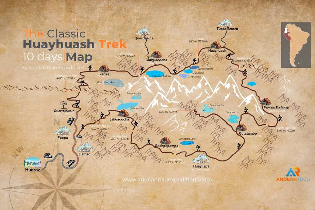
| Day | Itinerary | Distance | Walking time | Max. altitude | Difficulty |
|---|---|---|---|---|---|
| 1 | Huaraz → Pocpa (breakfast) → Cuartelhuain → Cacananpunta pass → Janca (Mitucocha) | 10 km (6.2 mi) | 4–5 h | 4,690 m (15,387 ft) | Moderate |
| 2 | Janca → Alcay pass → Carhuacocha | 10 km (6.2 mi) | 6–7 h | 4,780 m (15,682 ft) | Moderate |
| 3 | Carhuacocha → Tres Lagunas → Siula pass → Huayhuash | 14 km (8.7 mi) | 6–7 h | 4,800 m (15,748 ft) | Challenging |
| 4 | Huayhuash → Trapecio pass → Elephant Valley (Pampa Elefante) | 12 km (7.5 mi) | 6–7 h | 5,000 m (16,404 ft) | Challenging |
| 5 | Elephant Valley → Santa Rosa pass → Cutatambo | 7 km (4.3 mi) | 4–5 h | 5,100 m (16,732 ft) | Moderate |
| 6 | Cutatambo → Cerro Gran Vista → Cutatambo | 14 km (8.7 mi) | 5–6 h | 5,120 m (16,797 ft) | Moderate |
| 7 | Cutatambo → Huayllapa village | 12 km (7.5 mi) | 4–5 h | 4,250 m (13,943 ft) | Easy |
| 8 | Huayllapa → Tapush pass → Gashpapampa | 12 km (7.5 mi) | 6–7 h | 4,750 m (15,583 ft) | Challenging |
| 9 | Gashpapampa → Yaucha pass → Jahuacocha | 9 km (5.6 mi) | 5–6 h | 4,850 m (15,912 ft) | Moderate |
| 10 | Jahuacocha → Mancan Punta pass → Pocpa → Huaraz | 9 km (5.6 mi) | 4–5 h + drive 5 h | 4,550 m (14,927 ft) | Moderate |
Campsite altitudes: Cuartelhuain 4,180 m · Janca 4,270 m · Carhuacocha 4,140 m · Huayhuash 4,300 m · Elephant Valley 3,900 m · Cutatambo 4,250 m · Huayllapa 3,500 m · Gashpapampa 4,600 m · Jahuacocha 4,050 m.
Days 1–3: Straight Into the Lakes
We pick you up at your Huaraz hotel at 4 am and drive via Chiquián toward the trailhead. On the way we stop for breakfast in the village of Pocpa. We’re committed to supporting the communities of the Huayhuash, so rather than eat on the bus, we sit down at a local family’s table and spend our money where it stays in the valley.
About five hours after leaving Huaraz we reach Cuartelhuain, where our arrieros are waiting with the donkeys. While they load the duffels, tents and kitchen, you set off with your day pack. Rather than camp at the roadhead like most groups, we start walking the same morning: a four-hour hike over the Cacananpunta pass (4,690 m), on the Continental Divide, past Pucacocha lake and down to our camp at Janca, near Laguna Mitucocha, beneath Ninashanca and Rondoy. Reaching your first lake camp on day one gives you an extra day in the mountains.

Day two crosses the Alcay pass, past Alcaycocha, with Siula Grande, Yerupajá and Jirishanca coming into view before the long descent to Carhuacocha. This is the lake that convinces most people to come to the Huayhuash, and on a clear night the stars over it are unforgettable.
Day three is the morning everyone remembers. Get up for the sunrise reflection on Carhuacocha, then climb past Siulacocha, Quesillacocha and Azulcocha, turquoise lakes stacked one above the other beneath Siula Grande and Yerupajá. The Tres Lagunas viewpoint above them is the photo you’ve almost certainly seen. The Siula pass follows, then a descent past Laguna Carnicero to the Huayhuash camp.

Days 4–6: The High South
This is where our route parts ways with most Huayhuash itineraries. Instead of dropping to Laguna Viconga and its hot springs, we climb to the Trapecio pass at 5,000 m (16,400 ft), with close views of Puscanturpa, Cuyoc and Milpo, before a long descent to Elephant Valley, named after a rock formation you’ll recognize as soon as you see it.

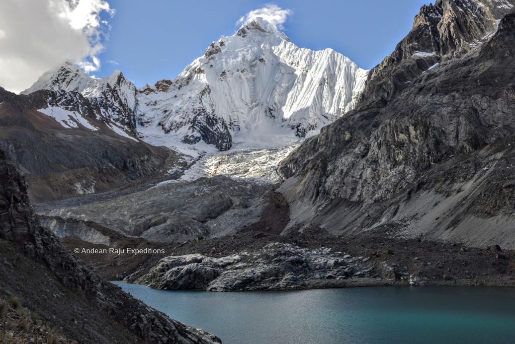
Day five is the big one: the Santa Rosa pass at 5,100 m (16,730 ft) is the highest pass of the trek. From the top you look across Jurau lake and peak to Sarapo, Siula Grande, Yerupajá and Rasac, then descend to Cutatambo, right beneath Siula Grande’s west face.
On day six we stay put. Leave the tents where they are and hike up to the Gran Vista viewpoint at 5,120 m (16,797 ft), past the glacial lakes of the Touching the Void base camp. It’s a 5–6 hour round trip and the highest point of the whole trek, with one of the most dramatic panoramas in the Andes: Siula Grande, Yerupajá and Sarapo in a single sweep of ice. With only a day pack and a night’s sleep at the same camp on either side, it’s also excellent acclimatization for the passes still to come.
Days 7–10: The Quiet West
Day seven is an easy descent through the Huayllapa canyon, with its waterfalls, lupin (tarwi) fields and the Calinca river, to Huayllapa, the only real village on the route. The village has a small shop and a few basic guesthouses. If you’d like a break from the tent, you can rent a room for the night for about S/ 30–40 per person (optional, paid locally): that gets you a comfortable bed, a hot shower and free Wi-Fi. Either way, expect a very good night’s sleep at 3,500 m.
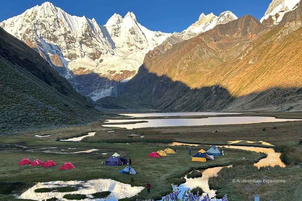
Day eight climbs steadily over the Tapush pass, below Diablo Mudo, past Susococha lake to Gashpapampa, at 4,600 m the highest campsite of the circuit. Day nine crosses the Yaucha pass, where the whole range spreads out in front of you, and drops to Jahuacocha, a lake cradled beneath the west faces of Yerupajá, Jirishanca and Rondoy. Many of our guides rate it the finest campsite of the trek, and we celebrate with a traditional Andean drink by the water.
On the last morning we cross the Mancan Punta pass (4,550 m) for a final look at the northern Huayhuash, then descend to the village of Pocpa, where our private transport takes you back to Huaraz, about five hours away.
Guide’s tip: Days four and five, with back-to-back passes at 5,000 and 5,100 m, are where the trek is won or lost. Walk the first three days more slowly than you think you need to, and you’ll still have the legs for Trapecio and Santa Rosa.
8 Days or 10 Days? How Our Two Circuits Compare
Both treks follow the same route for the first five days: Janca, Carhuacocha, the Tres Lagunas, the Trapecio pass and the Santa Rosa pass to Cutatambo. They split in the second half.
| Day | 10-day circuit | 8-day circuit |
|---|---|---|
| 1–5 | Huaraz → Janca → Carhuacocha → Huayhuash → Elephant Valley → Cutatambo | Same |
| 6 | Gran Vista viewpoint (5,120 m), second night at Cutatambo | Cutatambo → Huayllapa canyon → Huatiag camp (6 h) |
| 7 | Cutatambo → Huayllapa village | Huatiag → Tapush and Yaucha passes → Jahuacocha (6 h) |
| 8 | Huayllapa → Tapush pass → Gashpapampa | Jahuacocha → Mancan Punta pass → Pocpa → Huaraz |
| 9 | Gashpapampa → Yaucha pass → Jahuacocha | — |
| 10 | Jahuacocha → Mancan Punta pass → Pocpa → Huaraz | — |
What you gain with 10 days:
- Gran Vista. A full day at Cutatambo to hike up to the viewpoint at 5,120 m, the highest point of the trek, beneath Siula Grande.
- A night in Huayllapa village, with the option of a room, a hot shower and Wi-Fi.
- An easier rhythm. One pass a day in the second half, a night at Gashpapampa and shorter stages, which makes a real difference at this altitude.
Why choose 8 days:
- Two fewer days, if your time in Peru is limited.
- You still see the essentials: Carhuacocha, the Tres Lagunas, both 5,000 m passes, Cutatambo and Jahuacocha.
- It’s more demanding. Day seven crosses two high passes back to back, so the 8-day trek suits fit, well-acclimatized hikers.
If you can spare the time, we recommend the 10-day circuit. Book the 10-day trek or the 8-day trek.
Add a Summit: Climb After Your Trek
Ten days above 4,000 m leaves you superbly acclimatized, and many trekkers use that fitness to climb a 5,000 or 6,000 m peak straight afterwards. From Huaraz, popular choices in the Cordillera Blanca are Mateo (5,150 m) and Vallunaraju (5,686 m) for first-timers, Pisco (5,752 m) for a classic glacier climb, and Chopicalqui (6,354 m) or Alpamayo (5,947 m) for experienced mountaineers. You can even stay in the Huayhuash and climb Diablo Mudo (5,350 m), which rises above the trail near Gashpapampa. Ask us about combining your Huayhuash trek with a climb.
4, 7, 8, 10 or 12 Days: Which Huayhuash Trek Should You Choose?
The name “Huayhuash trek” covers several routes. Here’s how they compare:
| Version | Approx. distance | What you see | Best for |
|---|---|---|---|
| 6 days | 70–80 km (43–50 mi) | The eastern lakes and the high south, finishing at Huayllapa | Hikers who are short on time but want the headline views |
| 8 days | 100–110 km (62–68 mi) | Most of the classic loop, with two passes on day seven | Fit trekkers with a week and a bit |
| 10 days (our classic) | 115–130 km (71–80 mi) | The full circuit, with a day at Cutatambo for Gran Vista | Most trekkers; the best balance of pace and scenery |
| 12 days | 130 km+ (80 mi+) | The full circuit plus extra side trips and a rest day | Photographers and anyone who wants time to linger |
Not sure? Choose the 10-day circuit if you can spare the time. The extra days are what let you enjoy the passes instead of simply surviving them. See our 10-day Huayhuash trek and 8-day Huayhuash trek for dates.
Highlights Just Off the Main Trail
- Carhuacocha at first light (day 3). No extra walking, just an alarm clock. The reflection of Yerupajá and Jirishanca on still water lasts only minutes after sunrise.
- Tres Lagunas viewpoint (day 3). A short, steep detour above the Siula pass trail to the classic view of three lakes in a row. Go early, before clouds build on the summits.
- The Trapecio lakes (day 4). Our route trades the Viconga hot springs for the higher Trapecio pass, and the small glacial lakes below it are some of the least-visited corners of the range.
- Gran Vista (day 6). A full day at Cutatambo lets you reach the viewpoint above the Touching the Void base camp without rushing.
- Laguna Solterococha (day 9). If you still have energy on arrival at Jahuacocha, the walk up to this glacial lake beneath Yerupajá is a beautiful way to end the day.
Short on Time? Our 6-Day Huayhuash Trek
If ten days is out of reach, our 6-day trek covers the eastern lakes and the high south, where many of the headline views are. It starts like the full circuit at Cuartelhuain, and instead of looping back to Pocpa it exits through Huayllapa. From there our transport drives you via Cajatambo down to Barranca, on the coast, which is convenient if you’re heading straight back to Lima.
| Day | Stage | Highlight |
|---|---|---|
| 1 | Huaraz → Cuartelhuain → Janca (Mitucocha) | Cacananpunta pass, first glacial lake |
| 2 | Janca → Carhuacocha | Yerupajá and Jirishanca across the water |
| 3 | Carhuacocha → Siula pass → Huayhuash | Tres Lagunas viewpoint |
| 4 | Huayhuash → Trapecio pass → Elephant Valley | Glaciers of Nevado Trapecio |
| 5 | Elephant Valley → Santa Rosa pass → Cutatambo | The highest pass, beneath Siula Grande |
| 6 | Cutatambo → Huayllapa → Cajatambo → Barranca | Huayllapa canyon, then the drive to the coast |
The trade-off is that you skip the Gran Vista day and the quiet west (Gashpapampa and Jahuacocha), and the shorter schedule leaves less time to adjust to altitude on the trail. It suits hikers who have already spent a week up high, for example after the Santa Cruz trek.
How Hard Is the Huayhuash Trek?
Hard, but not technical. On the standard circuit you won’t need ropes, crampons or climbing skills. What wears people down is the combination: a pass nearly every day, 7,000 m (23,000 ft) or more of total climbing, cold nights and thin air from start to finish. The good news is that every one of those challenges responds to preparation.
Here’s how it compares with treks our clients often mention:
| Trek | Days | Highest point | Compared with the Huayhuash |
|---|---|---|---|
| Inca Trail | 4 | 4,215 m (13,830 ft) | Much shorter and lower, on well-built stone paths |
| Salkantay | 4–5 | About 4,600 m (15,090 ft) | One big pass, then mostly downhill |
| Santa Cruz | 4 | 4,750 m (15,580 ft) | A great rehearsal: similar altitude, a quarter of the length |
| Tour du Mont Blanc | 10–11 | About 2,600 m (8,530 ft) | Similar length and climbing, at roughly half the altitude, with huts |
| Everest Base Camp | 12 | About 5,360 m (17,590 ft) | Higher, but on busier trails with teahouses every few hours |
What the Trail Is Actually Like
Expect a bit of everything: grassy valley floors, boggy meadows, rocky moraines, loose scree on the steeper passes and a few narrow traverses. The main trail is generally clear, but it splits often, and a handful of junctions confuse even experienced hikers. Descents are where most people slow down, so trekking poles earn their place.
On a supported trek, donkeys carry the tents, kitchen and your duffel, and you walk with a 5–7 kg (11–15 lb) day pack. Going unsupported means 18–22 kg (40–48 lb) on your back at 4,500 m, which is a very different trip.
Altitude: The Part You Can’t Rush
Nearly every night on the circuit is spent above 4,000 m (13,100 ft). Acute mountain sickness, known locally as soroche, doesn’t care how fit you are; it cares how quickly you climbed. That’s why we ask every Huayhuash client to spend at least three full days in Huaraz (3,050 m / 10,000 ft) first, with progressively higher day hikes:
- Day 1: An easy walk to Laguna Wilcacocha (3,700 m / 12,140 ft) or the Wilcahuain ruins.
- Day 2: Laguna Churup (4,450 m / 14,600 ft), short but steep, with a scramble near the top.
- Day 3: Laguna 69 (4,600 m / 15,090 ft). If this feels manageable, you’re ready for the circuit.
Already done the Santa Cruz trek? Then you’re in excellent shape to start the Huayhuash a day or two later.
On the trail, our guides carry emergency oxygen, a pulse oximeter and a full first-aid kit, and they watch every client closely. If someone feels unwell, we check their blood oxygen and pulse straight away. If symptoms get worse despite rest, we go down. There’s no shame in it, and the mountains will still be there.
Altitude Sickness: Warning Signs and What We Do
Mild symptoms are normal during the first days above 4,000 m. What matters is spotting when they stop being mild.
| Level | Signs | What happens next |
|---|---|---|
| Normal adjustment | Slight headache that eases with water and rest, heavy breathing on climbs, a restless first night | Keep walking slowly, drink more, eat even without appetite |
| Mild AMS | Headache plus nausea, dizziness, poor sleep, unusual tiredness | A rest day or a slower stage; no more ascent until symptoms ease |
| Serious (HAPE or HACE) | Breathlessness at rest, a wet cough, confusion, stumbling, extreme drowsiness | Immediate descent with oxygen and evacuation. This is an emergency |
Three questions we hear every season:
- Does coca tea work? It’s a traditional, mild remedy that most Peruvians swear by. It doesn’t replace proper acclimatization.
- Should I take acetazolamide (Diamox)? Some trekkers use it for prevention. Discuss it with your doctor before you travel, not in Huaraz.
- What about alcohol and sleeping pills? Skip both for the first nights at altitude; they can slow your breathing while you sleep.
Evacuation Routes: What Happens If Someone Gets Sick
Altitude sickness is the most common reason a trekker has to leave the Huayhuash early. The range is remote, and most campsites are around 8 hours by road from Huaraz, so every guide needs to know the fastest way out from each section of the circuit. These are the exit routes we use:
| If you’re at… | Evacuation route |
|---|---|
| Carhuacocha camp | Out via the town of Cajatambo |
| Huayhuash camp | Out via the village of Tupac Amaru |
| Viconga camp (classic route) | Out toward Barranca, on the coast |
| Huayllapa village | By road via Cajatambo down to Barranca |
When someone needs to leave, the guide first gives oxygen and first aid and gets them walking or riding the emergency horse down to a lower altitude. From the nearest road, a private vehicle takes them to Huaraz or to the coast. Because these are remote mountain roads, a private evacuation vehicle costs around S/ 1,200–1,500 (about US$ 320–400). It isn’t included in the trek price, which is one more reason to make sure your travel insurance reimburses emergency transport and medical costs.
An 8-Week Training Plan
You don’t need to be an athlete, but you do need legs and lungs that recover overnight. This is the plan we send our own clients; adjust it to your starting point.
| Weeks | Focus | What to do |
|---|---|---|
| 1–2 | Base | 3 × 45 minutes of cardio (brisk walking, cycling, running), plus 2 short strength sessions: squats, lunges, step-ups, planks |
| 3–4 | Build | Add a weekend hike of 3–4 hours with 600 m (2,000 ft) of ascent, carrying 6–8 kg (13–18 lb) |
| 5–6 | Back-to-back | Hike on consecutive days (5 h + 4 h) with 800–1,000 m (2,600–3,300 ft) of ascent; include long, steep descents |
| 7 | Peak | Your biggest weekend: two days of 6 hours each, ideally in hills or mountains |
| 8 | Taper | Keep moving but halve the volume; sleep well and arrive in Huaraz rested |
No hills where you live? Stair machines, a steep treadmill incline and stadium stairs all work. Break in your boots between weeks 3 and 7, never on the trek itself.
The Mental Side
Fitness gets you over the passes; attitude gets you through the days. Expect early starts, cold hands at breakfast, basic toilets and a few hours each afternoon with nothing to do but rest. Take it one pass at a time, walk at your own pace, and remember that feeling slow at 4,800 m is normal, not a sign that you’re failing.
Guide’s tip: The clients who do best aren’t always the fittest. They’re the ones who walk slowly on the first days, drink three to four liters of water a day, and tell us about a headache early instead of hiding it.
When Is the Best Time to Trek the Huayhuash?
The Andes around Huaraz have two seasons: dry from May to September and wet from October to April. The Huayhuash trekking season follows the dry months almost exactly, and we run departures from mid-April to November.
| Month | Conditions | Our verdict |
|---|---|---|
| April | Rain easing off, green valleys, snow lingering on the passes | Only for flexible, experienced trekkers |
| May | Mostly dry, lush landscapes, fewer groups | A lovely month if you don’t mind the odd shower |
| June | Clear skies and cold nights as the season finds its stride | Excellent |
| July | The most stable weather, the coldest nights, the busiest camps | Excellent; book early |
| August | Dry and bright, with windier afternoons | Excellent |
| September | Still dry and a little warmer; clouds build later in the month | Very good |
| October–March | Wet season: daily storms, snow on the passes, muddy trails | Not recommended |
Guide’s tip: If your dates are flexible, aim for late May or the first half of September. You get dry-season weather with noticeably quieter campsites.
Huayhuash Temperatures by Altitude
On the Huayhuash, altitude and sunshine matter far more than the calendar. This is a realistic guide for the dry season:
| Where | Altitude | Daytime | Night |
|---|---|---|---|
| Huaraz | 3,050 m (10,000 ft) | 18–24 °C (64–75 °F) | 4–8 °C (39–46 °F) |
| Huayllapa village | 3,500 m (11,480 ft) | 15–20 °C (59–68 °F) | 0–5 °C (32–41 °F) |
| Lake camps (Carhuacocha, Jahuacocha) | 4,000–4,200 m (13,100–13,800 ft) | 10–16 °C (50–61 °F) in sun | –2 to –7 °C (28–19 °F) |
| High camps (Huayhuash, Gashpapampa) | 4,300–4,500 m (14,100–14,800 ft) | 8–14 °C (46–57 °F) in sun | –5 to –10 °C (23–14 °F) |
| Passes | 4,600–5,100 m (15,100–16,730 ft) | 0–10 °C (32–50 °F), often windy | — |
The drop when the sun slips behind a ridge is dramatic: a camp can go from T-shirt weather to freezing in less than an hour. Even in July you can see sunshine, wind, hail and a dusting of snow on the same day, so a waterproof shell and a warm layer live in your day pack every day.
How to Get to the Huayhuash
Lima to Huaraz. Huaraz is roughly 400 km (250 miles) from Lima, up the coast and into the mountains. Two bus companies we recommend are Móvil Bus and Cruz del Sur, both running comfortable day and overnight services that take around 8 hours; pay a little extra for the reclining “cama” seats. If you’d rather fly, LATAM operates two daily flights between Lima and Anta airport, 40 minutes to an hour by road from Huaraz, which saves most of a day.
Choosing your bus seat. Most companies offer two classes: semi-cama seats that recline to about 140 degrees, and cama or VIP seats that recline almost flat, at around 180 degrees. On an overnight trip the flatter seat is worth the few extra soles: a one-way ticket usually costs around S/ 60–120 (US$ 16–32) depending on the class.
Coming from northern Peru? If you’re traveling down the coast, Móvil Bus and Línea run overnight buses from Trujillo to Huaraz in about 8–9 hours, a handy way to fit the Huayhuash into a longer trip around Peru.
Huaraz to the trailhead. The circuit starts at Cuartelhuain, reached via the town of Chiquián. By private transfer it takes about 5 hours, partly on dirt roads; on our treks we pick you up at your hotel at 4 am so you can start walking the same day. Independent trekkers can take a bus to Chiquián and a local van onward to Llamac or Pocpa, which is slower and often means a night on the way. Our private transport back to Huaraz leaves from Pocpa on the last day.
Your extra luggage. You won’t need your city clothes on the trail. Most Huaraz hotels store bags for free while you trek, and you’re also welcome to leave your extra luggage with us.
How many days in total? For the 10-day circuit, allow around 15 days from Lima: a travel day to Huaraz, three days of acclimatization, ten on the trek, and a buffer day before your flight home.
How Much Does the Huayhuash Trek Cost?
Community Fees
Instead of one park entrance, you pay each community whose land you camp on. Collectors meet you at or near the campsites and issue a printed receipt. Keep every one, as you may be asked to show earlier receipts further along. These are the 2026 rates per person, as published on Huayhuash.com:
| Community | Covers | Fee |
|---|---|---|
| Llámac | Cuartelhuain and part of Jahuacocha | S/ 50 |
| Huayllapa | Viconga, Guanacpatay and Huatiaq camps | S/ 50 |
| Queropalca | Mitucocha and part of Carhuacocha | S/ 40 |
| Quisuarcancha | Part of Carhuacocha | S/ 30 |
| Tupac Amaru | Huayhuash camp | S/ 30 |
| Uramaza | Viconga lake and hot springs | S/ 30 |
| Pacllón | Gashpapampa and part of Jahuacocha | S/ 30 |
| Pocpa | Various areas | S/ 20 |
| Cutatambo valley (optional) | Siula Grande base camp | S/ 10 |
| Full circuit | About S/ 290–300 |
Carry the fees in small notes, since change is scarce. On our route, which crosses the Trapecio pass instead of visiting Viconga, the fees come to about S/ 280 per person. They are paid directly by each trekker and aren’t included in our trek price.
Guided or Independent?
Both work. The right choice depends on your experience, your Spanish and where you’d rather spend your energy.
| Guided and supported | Independent | |
|---|---|---|
| Your pack | 5–7 kg (11–15 lb) day pack | 18–22 kg (40–48 lb) with tent, stove and food |
| Route finding | A guide who knows every junction and variant | Offline maps (Gaia GPS, Maps.me) and good judgment |
| Meals | Three hot meals a day, cooked for you | Whatever you carried |
| Camp | Tents pitched, dining tent, hot meals served | You set up and pack down every day |
| If something goes wrong | Certified guide, first-aid kit, an emergency horse and an evacuation plan | You and your partners, a long way from help |
| Transport | Private transfers | Public buses and local vans |
Independent budget: community fees (around S/ 300), transport to and from the trailhead, ten days of food and fuel, gear rental in Huaraz if needed and, optionally, an arriero with a donkey to carry your load.
Guided with Andean Raju: our 10-day circuit costs US$ 870 per person. It includes private transport (Huaraz to the trailhead and Pocpa back to Huaraz), a certified English- and Spanish-speaking trekking guide, a professional cook, donkeys and arrieros carrying up to 10 kg per person, five meals a day, four-season tents for two, a dining tent, boiled drinking water, warm water for washing, a first-aid kit and an emergency horse. Not included: community fees (about S/ 280), sleeping bag, insurance, hotels in Huaraz and tips. Groups are capped at 9 trekkers, and private departures run on any date in the season.
How to Choose a Huayhuash Trek Operator
Prices in Huaraz vary widely, and the cheapest trek usually saves money somewhere you’ll feel it. Before you book, ask:
- Who is the guide, and what are their qualifications? Your guide should hold an official certification. In Huaraz that can mean an international mountain-guide qualification (IFMGA or UIMLA), but also Peru’s official tourism guides who specialize in trekking: they’re licensed by the Peruvian government, authorized to lead groups, and many have years of experience on this circuit.
- What safety equipment comes on the trek? Emergency oxygen, a pulse oximeter, a proper first-aid kit and a satellite communicator or radio.
- Is there an emergency horse? On a trek this remote, it can make the difference between walking out and waiting for help.
- What exactly is included? Community fees, transport, sleeping bags and mats are the items most often left out.
- How big are the groups? Small groups move at a kinder pace and are easier to adapt when someone feels unwell.
- Is it a legally registered agency? This matters more than any other point on the list (see below).
- How are the crew and animals treated? Fair wages for arrieros and cooks, and donkeys that aren’t overloaded, are signs of an operator you can trust.
Why Book With a Licensed Local Agency
It’s tempting to hire a freelance guide you met in a café or online to save a few dollars. We strongly recommend booking your trek directly with a legally authorized local agency that provides a certified guide. Here’s why:
- Legal accountability. A registered agency has a legal representative and is responsible for your trip. If something goes wrong, there is a company that must answer for it.
- Support when it matters. An agency can organize evacuations, replacement transport, medical care and insurance paperwork. An independent guide working alone may not have the resources or the obligation to do so, and in the worst cases travelers have been left without support after an accident.
- Verified guides. Agencies are required to work with certified guides; an informal guide may not hold any certification at all.
- A fair contribution. Licensed agencies pay taxes in Peru, pay community fees properly and support the villages along the route.
Ask for the company’s registration details before you pay, and make sure your contract names both the agency and your guide.
Solo, With Friends or in a Group?
Joining a Group vs. Booking a Private Trek
You can book a private trek for just your own party, or join a small group of other travelers. A private trek lets you set the pace and the dates. A shared group costs less per person, and ten days of passes, cold mornings and card games at camp turn strangers into friends surprisingly fast. Either way, our groups never exceed 9 trekkers.
Advice for Solo Female Trekkers
We don’t recommend that women trek the Huayhuash alone. The circuit is remote, there’s no phone signal for days, and help can be many hours away. Joining a guided group solves that: you’re never alone on the trail, the guide or cook always walks with the last person, and there’s a first-aid kit and an emergency horse if anything goes wrong.
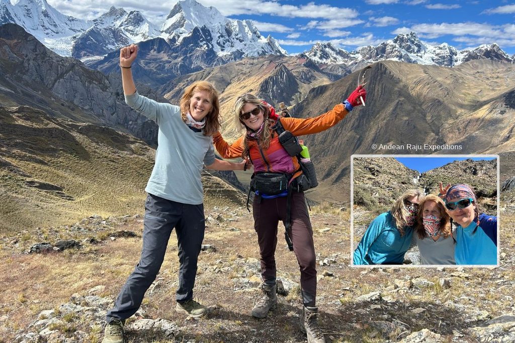
The question we’re asked most is about tents. On shared treks, tents are for two people, so here’s how we handle it:
- Share with another woman. We always place solo female travelers in a tent with another woman.
- Rent a private tent. A single tent costs S/ 30 per day, so you have your own space every night.
Small practical tips from women who have done the trek: bring a menstrual cup or enough supplies for the whole trip (there are no shops between villages), keep them in your day pack, and pack a sealable bag for used items so nothing is left behind.
Life on the Trail: What a Day Really Looks Like
People often ask what the days feel like, not just where they go. Here’s a typical one on our treks:
- 5:30–6:00 am. A guide brings coca tea or coffee to your tent, whose walls may be stiff with frost.
- 6:30 am. Breakfast in the dining tent: porridge, eggs, bread, fruit and more tea. You also get a box lunch for the trail.
- 7:15 am. Start walking. The arrieros strike camp, load the donkeys and overtake you later in the morning.
- Late morning. The pass: photos, snacks, an extra layer, then the descent.
- 1:00–2:00 pm. A packed lunch or a hot one, depending on the stage.
- 3:00 pm. Arrive at a camp that’s already pitched. Wash, rest, stroll to a viewpoint or just watch the light change on the peaks.
- 5:00 pm. Tea time with popcorn or biscuits as the temperature falls fast.
- 6:30 pm. A three-course dinner: soup, a main such as lomo saltado, quinoa, trout or pasta, and dessert.
- 8:00 pm. Bed. The stars at 4,300 m are something you won’t forget.
Food and diets: our cooks prepare fresh meals every day, and vegetarian, vegan and gluten-free diets are no problem; just let us know when you book. Bring a few favorite snacks for the passes.
Water: we boil all drinking water daily, and bring you warm water for washing. Toilets: every campsite has community-run toilets. They’re basic and not always clean, but private toilet tents aren’t permitted by the communities, so bring toilet paper and hand sanitizer. Showers: as an exclusive service for our clients, we set up two warm showers during the circuit, at Elephant Valley (Pampa Elefante) and Jahuacocha; the rest of the time you’ll wash with wet wipes and a basin of warm water. Signal: there’s no mobile coverage on most of the circuit. Some campsites offer paid Starlink Wi-Fi, and our guides can get phone signal for calls on some of the high passes.
Guide’s tip: Our arrieros come from the Huayhuash communities of Pocpa, Llamac and Queropalca, and some have walked this loop hundreds of times. Ask them the Quechua names of the mountains; it’s one of the best conversations you’ll have on the trek.
Tipping Your Trek Team
Tips are voluntary, but on a ten-day trek they’re an important part of your crew’s income. Most groups fill a shared envelope on the last evening and present it together, which keeps things fair. As a rough guide per trekker for the full 10-day circuit:
| Crew member | Suggested total per trekker |
|---|---|
| Lead guide | US$ 70–100 |
| Cook | US$ 40–60 |
| Arrieros (shared) | US$ 40–60 |
Pay in soles if you can, and adjust for group size and service.
Money, Power and Staying Connected
- Cash: bring enough cash with you. Every fee, drink and tip on the circuit is paid in cash, there are no ATMs once you leave Huaraz, and ATMs in Peru usually cap withdrawals at around US$ 200 a day, so start withdrawing a few days before the trek or bring some cash from home.
- Charging: there’s no electricity at the campsites. Bring a 20,000 mAh power bank or a small solar panel; Huayllapa, on day seven, is your one chance to top up.
- Airplane mode all the way: there’s no signal to search for anyway, and a phone in airplane mode can last several days on a single charge.
- Batteries in the cold: lithium batteries drain fast below freezing. Sleep with your phone, camera batteries and power bank inside your sleeping bag.
- Being offline: download your maps in advance, and let family know you’ll be out of contact for the duration.
Photography Tips
- Carhuacocha and Jahuacocha: be at the shore 15 minutes before sunrise, when the wind is calmest and the reflections sharpest.
- The passes: clouds often gather on the summits by midday, so the clearest views usually come before 11 am.
- The night sky: with zero light pollution, the Milky Way is spectacular from May to August. A small tripod is worth its weight.
- People: ask before taking a portrait, and show the photo afterward. Plenty of arrieros are happy to pose with their donkeys.
Huayhuash Packing List
On our treks the donkeys carry your duffel (up to 10 kg / 22 lb per person) and you carry a day pack. This is what our guides check before every departure.
Sleeping
- A four-season sleeping bag with a comfort rating of –10 °C (14 °F) or lower; it isn’t included, but you can rent one from us or in Huaraz
- Sleeping mat; we rent foam mats if you don’t have one
- A warm hat and a pair of dry socks kept only for nighttime
Clothing
- Thermal base layers, top and bottom
- 2–3 quick-dry T-shirts (no cotton)
- Fleece or light insulated jacket
- Down or synthetic puffy jacket
- Waterproof jacket and trousers
- Two pairs of hiking trousers, plus leggings or long johns for camp
- Warm gloves and thin liner gloves
- Sun hat, beanie, buff and category 3–4 sunglasses
Footwear
- Broken-in waterproof hiking boots with ankle support
- Camp shoes or sandals
- 4–5 pairs of hiking socks
Day pack (25–35 L)
- 2–3 L (70–100 oz) of water capacity, plus purification tablets
- Sunscreen SPF 50+ and lip balm with SPF
- Snacks, a headlamp with spare batteries and a small first-aid kit
- Trekking poles (your knees will thank you on every descent)
- Cash in small soles notes for fees, drinks in Huayllapa and tips
Toiletries and first aid
- Wet wipes, biodegradable soap and a small quick-dry towel
- Toilet paper, hand sanitizer and a bag to pack out rubbish
- Blister plasters, ibuprofen or paracetamol, and stomach medication
- Any personal medication, including altitude medication if your doctor prescribes it
- Rich moisturizer, lip balm and hand cream: the dry, windy air at 4,500 m is hard on your skin
- Hair ties, a headband or a buff for the days without showers
Nice to have
- Power bank or small solar panel
- Earplugs for windy nights
- A book, e-reader or pack of cards for the long afternoons
- Dry bags to keep spare clothes dry inside your duffel
Missing something? We rent sleeping bags, mats and mountain clothing in Huaraz; ask us for current rental prices.
Safety and Responsible Trekking
The Huayhuash is remote, and the nearest hospital is back in Huaraz, many hours away, so good decisions matter more than usual. These are the rules we live by:
- Acclimatize first, always. Three days in Huaraz is the minimum, not a suggestion.
- Get the right travel insurance. Many standard policies stop covering outdoor activities above 3,000 or 4,000 m, so check the altitude limit in the small print and choose one that covers trekking up to 5,120 m (16,797 ft) and reimburses hospital, medical and emergency transport costs. An evacuation by private vehicle from the Huayhuash costs around S/ 1,200–1,500. We also strongly recommend trip-cancellation cover: every season a few travelers get altitude sickness or food poisoning in the days before the trek and miss their departure, and good cancellation insurance lets you recover part of what you paid.
- Respect turnaround times on the passes, especially when afternoon storms are building.
- Never trek alone. If you go independently, go with a partner and leave your route and dates with someone in Huaraz.
- Leave no trace. Pack out all rubbish, use the toilets provided and never wash with soap in lakes or streams.
- Pay every community fee and keep the receipts. That money keeps the campsites running and gives communities a reason to protect the range.
- Ask before photographing people, especially in villages like Huayllapa.
Mistakes We See Every Season
After years on this circuit, the same few errors come up again and again. Avoid these and you’re already ahead of most trekkers:
- Arriving in Huaraz and starting the trek two days later. Almost every early turnaround we see comes from rushed acclimatization.
- Racing the first two days. Feeling strong at 4,200 m is not the same as being acclimatized. Save it for Trapecio and Santa Rosa.
- Bringing a summer sleeping bag. A “0 °C” bag is not enough for a –8 °C night at Huayhuash camp.
- New boots. Blisters on day three are miserable, and there are seven days still to go.
- Not drinking enough. Dry air and hard breathing dehydrate you fast, and dehydration feels a lot like altitude sickness.
- Hiding symptoms from the guide. A headache mentioned at breakfast is easy to manage; the same headache ignored until the pass is not.
- Forgetting cash. There are no cash machines past Huaraz, and every community fee is paid in soles.
Huayhuash Trek FAQ
How long is the Huayhuash trek?
The classic circuit covers 110–130 km (70–80 miles) and takes 8 to 10 days. Shorter versions exist: our 6-day trek covers roughly 70–80 km, and 8-day routes about 100–110 km.
What’s the difference between the 8-day and 10-day Huayhuash trek?
The first five days are the same. The 10-day circuit adds a full day at Cutatambo for the Gran Vista viewpoint (5,120 m) and a night in Huayllapa village, with one pass a day in the second half. The 8-day trek camps at Huatiag instead and crosses the Tapush and Yaucha passes on the same day, so it’s shorter but harder.
How many days do you need for the Huayhuash trek?
Most people choose 10 days for the full circuit. Strong, well-acclimatized hikers can manage 7 or 8, and photographers often stretch it to 12. Add three or four days in Huaraz beforehand to acclimatize.
Is the Huayhuash harder than the Inca Trail or the Salkantay trek?
Yes, considerably. It’s two to three times longer, stays higher for longer and crosses a high pass almost every day. It’s not technical, though, and fit hikers who acclimatize properly finish it every season.
What is the highest point on the Huayhuash circuit?
On our route, the highest pass is Santa Rosa at 5,100 m (16,730 ft), and the day-six hike to the Gran Vista viewpoint reaches 5,120 m (16,797 ft). Other itineraries top out at the similarly high Cuyoc or San Antonio passes. Most campsites sit between 3,900 and 4,600 m (12,800–15,090 ft).
Can a beginner do the Huayhuash trek?
A fit beginner with some hiking background can, provided they train for two months and acclimatize properly. If you’ve never done a multi-day trek, try the Santa Cruz trek first, or our 6-day Huayhuash with extra days in Huaraz.
Can you do the Huayhuash without a guide?
Yes. Experienced backpackers do it every year with offline maps and a heavy pack. You’ll carry everything, navigate some confusing junctions and handle any emergency far from help. Many independent trekkers compromise by hiring an arriero and donkey to carry the load.
When is the best time to trek the Huayhuash?
May to September, the dry season. June to August brings the most stable weather and the coldest nights; late May and early September are quieter.
How cold does it get at night on the Huayhuash?
In the dry season most campsites drop to between –2 and –10 °C (28 to 14 °F), with the coldest nights in June and July. Sunny days are pleasant, often 10–16 °C (50–61 °F).
How much are the Huayhuash community fees?
About S/ 280–300 per person for the full circuit in 2026, depending on the route, paid in cash to the communities along the way. Keep every receipt.
Do I need travel insurance for the Huayhuash?
Yes, we strongly recommend it. Choose a policy that covers trekking at altitude and reimburses medical and hospital costs in an emergency. Trip-cancellation cover is just as important: some travelers get altitude sickness or food poisoning in Huaraz and miss the trek, and good insurance helps you recover part of the cost.
Can I rent trekking gear in Huaraz?
Yes. Huaraz has plenty of shops renting sleeping bags, down jackets, trekking poles and boots. You can also rent gear directly from us: sleeping bags, foam sleeping mats, mountain clothing and equipment. Contact us for current rental prices. Whoever you rent from, check zips and insulation carefully, and pick it up a day early so you can swap anything that doesn’t fit.
Is the Huayhuash safe for solo female travelers?
Not on your own. We don’t recommend that women hike the Huayhuash alone: it’s remote, there’s no phone signal for days and help can be hours away. With a guided group it’s a different story. You’re never alone on the trail, a guide stays with the slowest walker, and we always share solo female travelers’ tents with another woman (or you can rent a private tent for S/ 30 a day).
Can I take a night bus to Lima right after the trek?
Yes. On the last day we arrive back in Huaraz between 4 and 5 pm, which leaves plenty of time to catch an overnight bus to Lima the same evening. If your schedule allows, one more night in Huaraz for a hot shower and a celebration dinner is a nice way to end the trip, but it isn’t necessary.
Is there phone signal on the Huayhuash?
Very little. Expect no mobile coverage for most of the trek. Some campsites offer paid Starlink Wi-Fi, and our guides can make calls from a few of the high passes where there is signal.
Are there hot springs on the Huayhuash trek?
Yes, at Laguna Viconga, on the classic route over the Portachuelo pass. Our itinerary takes the higher, quieter Trapecio pass instead, so it doesn’t stop at the hot springs; in exchange you get close-up glacier views and some of the least-visited lakes in the range.
How do you pronounce Huayhuash?
“WHY-wash.” It’s a Quechua name, and pronunciation varies a little even within Peru, so nobody will mind if you get it slightly wrong.
Is the Huayhuash worth it compared with the Santa Cruz trek?
If you have the time and fitness, absolutely. Santa Cruz is a superb four-day introduction to the Cordillera Blanca. The Huayhuash is a bigger, wilder journey, with more lakes, more passes and far fewer people. Many of our clients walk Santa Cruz one year and come back for the Huayhuash the next.
Walk the Huayhuash With Guides Who Call These Mountains Home
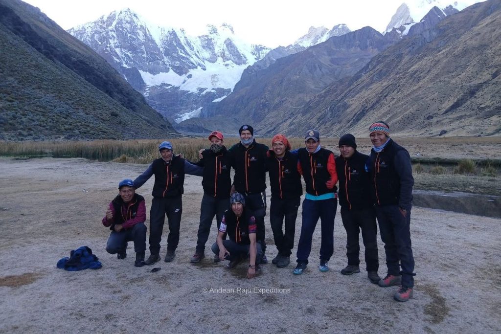
Andean Raju Expeditions is a legally registered agency based in Huaraz, working with certified mountain and trekking guides. We run small-group and private Huayhuash departures throughout the dry season, with our own cooks, arrieros and camp equipment, groups of no more than 9, and we build every itinerary around proper acclimatization.
See dates and prices for the 10-day Huayhuash Trek →
Not sure which version suits you, or want a custom trip that adds a Cordillera Blanca climb? Send us a message and one of our guides will reply personally within 24 hours.
[…] Huayhuash Trek Guide […]